Smarter, sharper, safer: Powerline inspection with DJI Zenmuse L3
DJI Zenmuse L3 drone LiDAR payload enhances critical infrastructure inspection in the utilities sector — as shown by data collected by National Grid and heliguy™.

- View sample datasets of powerline infrastructure, collected with the DJI Zenmuse L3 in partnership between National Grid and heliguy™;
- Highly-detailed datasets demonstrate the L3's capabilities for infrastructure inspection;
- Learn how the L3's feature stack is ideal for robust data collection in the energy sector;
- Find out how heliguy™ can help you start and scale your drone programme in the utilities industry.
The DJI Zenmuse L3 offers an advanced powerful solution for powerline and substation inspections — unlocking enhanced detail, precision, and efficiency in the utilities sector.
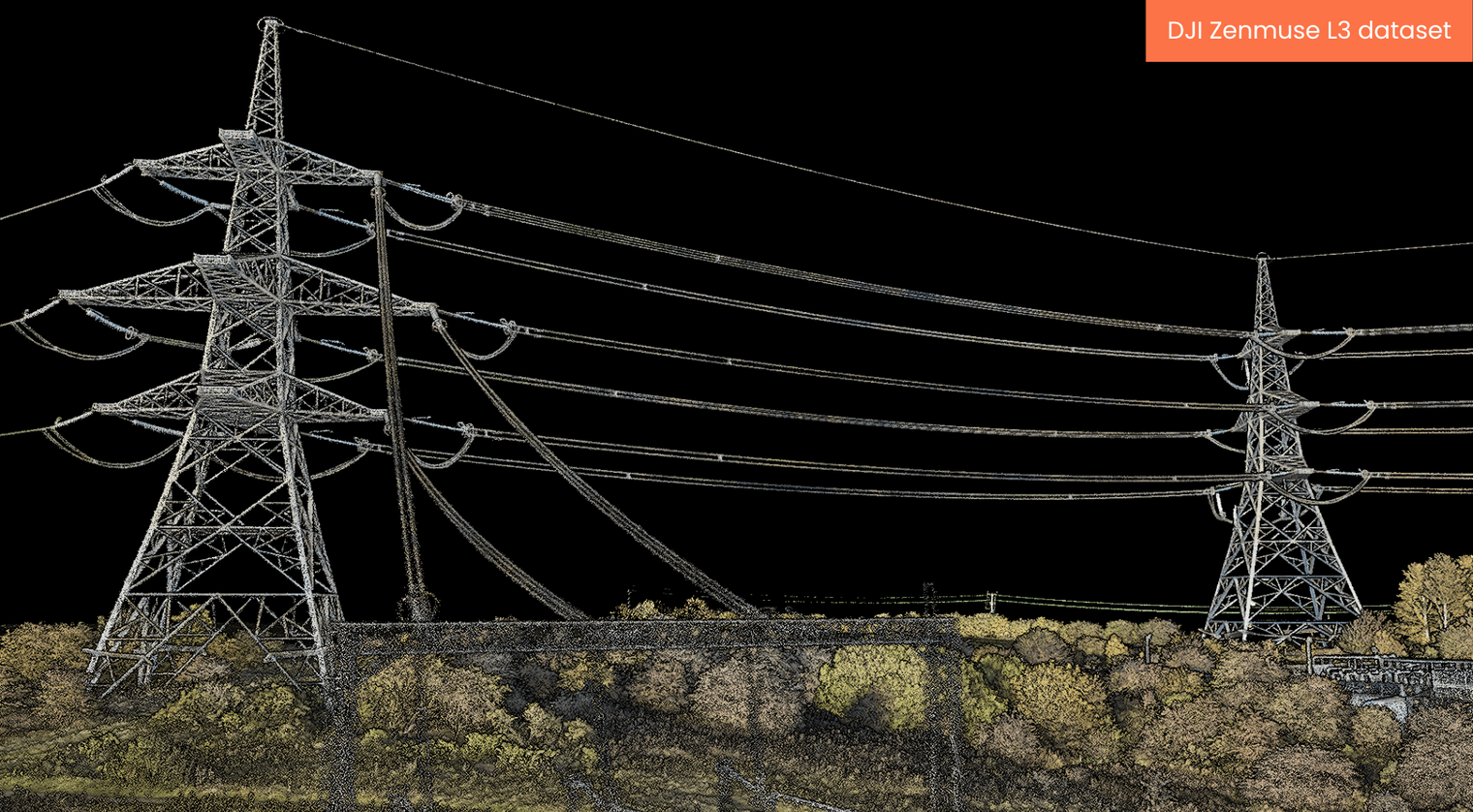
In collaboration with National Grid, heliguy™ tested the L3’s capabilities in real-world conditions — capturing a detailed dataset that highlights its capabilities for robust and reliable infrastructure monitoring and maintenance.
Key takeaways
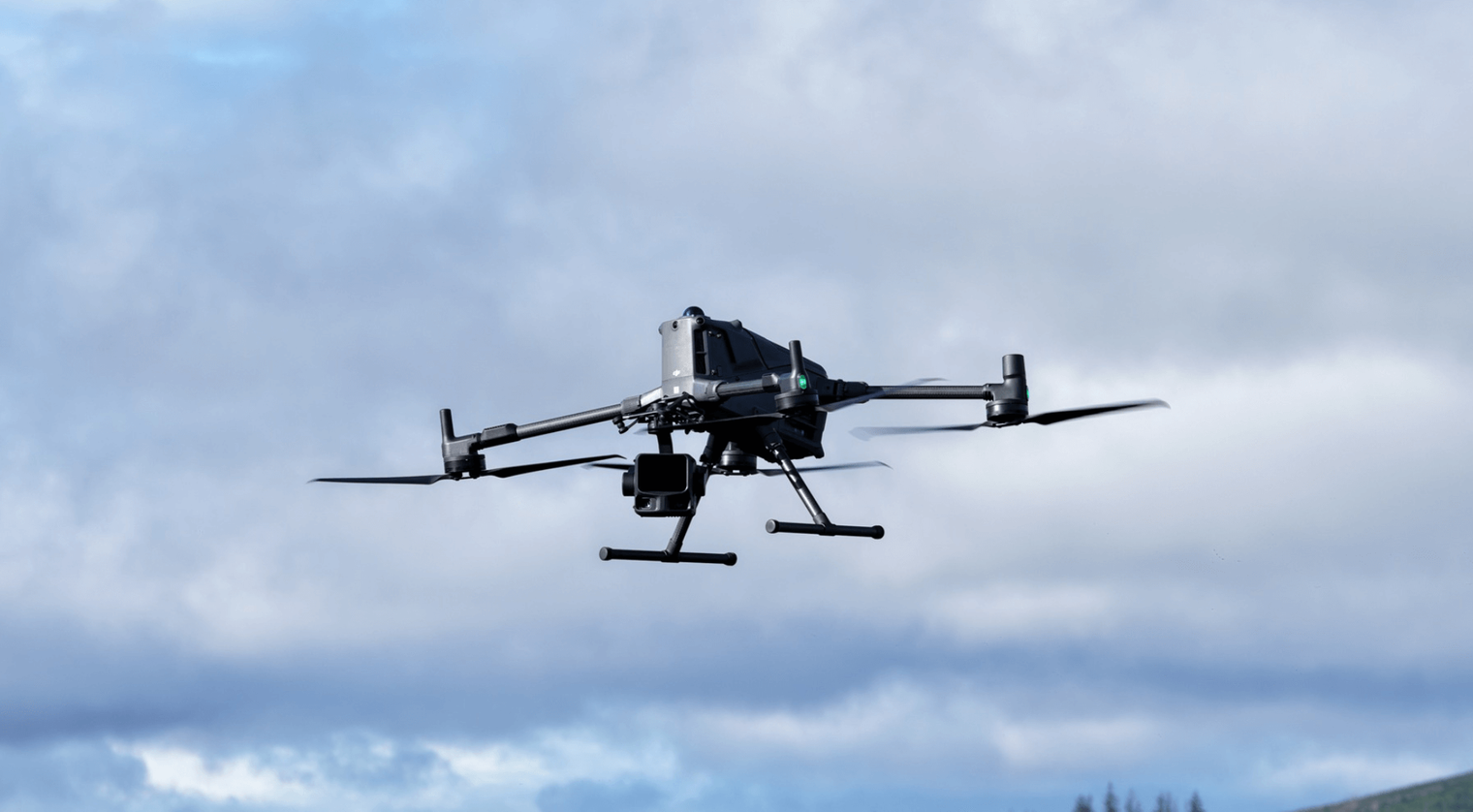
- heliguy™ and National Grid collaboration demonstrates the qualities of the DJI Zenmuse L3 (with DJI M400) for powerline and substation inspection.
- DJI Zenmuse L3 collects detailed datasets, with precise digital reconstructions of utility infrastructure, including thin wiring.
- Key features of the L3 for critical infrastructure modelling include up to 16 returns, tight beam divergence, 3cm vertical accuracy at 120m, long-range LiDAR, and dual 100MP camera system for enriched true-colour point clouds for enhanced visualisation.
- The L3 has upgraded features compared to the DJI Zenmuse L2. Read our in-depth L3 vs L2 comparison blog for more details.
- heliguy™ can help you start and scale your drone operations in the utility sector, offering a range of services, including consultancy, product supply, pilot training, and dedicated survey support.
Expert insight
“The Zenmuse L3’s upgrades directly address the challenges of powerline inspection — especially around detecting thin structures at range and maintaining precision over long linear assets. Combined with DJI Terra’s tailored Substation Mode, the L3 offers an end-to-end workflow for utilities operators looking to enhance safety, speed, and data quality in critical infrastructure monitoring.”
— Matthew Cairns, heliguy™ Enterprise account manager
Real-world testing: DJI Zenmuse for powerline and substation flights
heliguy™ partnered with National Grid to evaluate the DJI Zenmuse L3 across live inspection scenarios.
Mission overview
- Platform: DJI Matrice 400.
- Oblique substation flight: 90m altitude.
- Flight time: 32 minutes.
- Speed: 7.3 m/s.
- Sensor configuration: 16 returns | 350 kHz | 6K imagery | 20% side overlap.
- Additional capture: 5-minute ortho flight to cover downed lines.
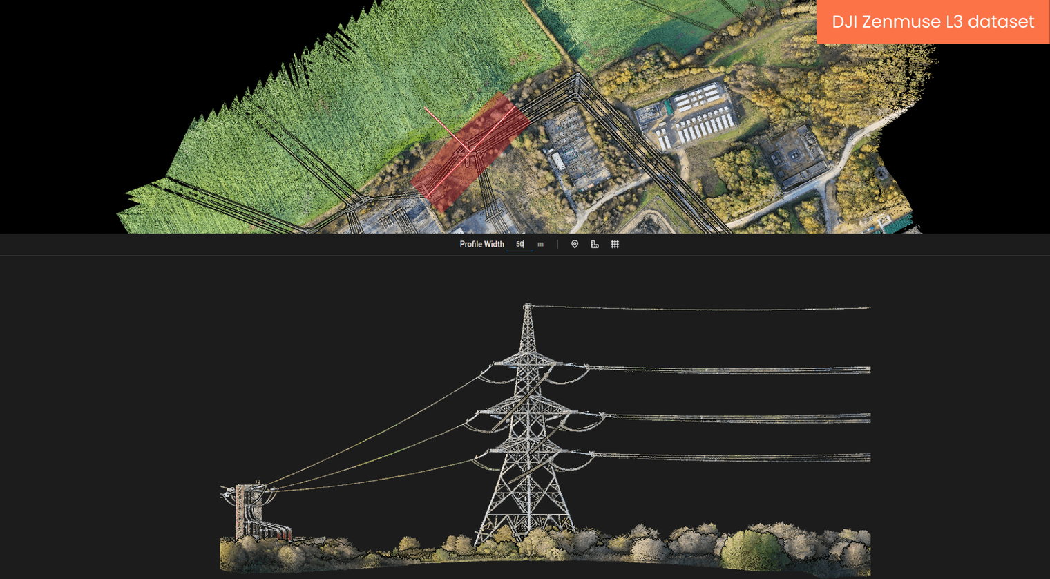
All data was processed using Substation Mode in DJI Terra, optimised for accurate 3D modelling of towers, lines, and electrical infrastructure.
Key features of DJI Zenmuse L3 for utility inspection
The table below highlights how the DJI Zenmuse L3's feature set benefits inspections in the energy sector.
The L3 has upgraded features compared to the previous generation DJI Zenmuse L2. Read our in-depth L3 vs L2 comparison blog for more details.
| Feature | Description | Benefit |
|---|---|---|
| 1535nm long-range LiDAR | Utilises an eye-safe wavelength to capture data over extended distances — ideal for long transmission corridors and substations. | Enables safe, high-altitude data collection without sacrificing density or range — reducing the need for multiple flight passes. |
| 5mm ranging repeatability at 150m | Achieves exceptional measurement consistency and precision across long-range scans. | Provides survey-grade reliability for sag analysis, vegetation clearance, and asset condition reporting. |
| 3cm vertical accuracy at 120m | Delivers engineering-level accuracy even at higher altitudes. | Ensures precise elevation and height data critical for compliance and safety in utility environments. |
| Up to 16 returns | Captures multiple reflections from each LiDAR pulse, producing dense and detailed point clouds. | Improves visibility of fine structures such as cables and insulators, even through vegetation or complex geometry. |
| 100MHz to 2KHz laser pulse rate | Offers a flexible pulse frequency range for different mission types and altitudes. | Balances data density and efficiency, optimising performance for both corridor mapping and detailed asset surveys. |
| 0.25 mrad laser beam divergence | Produces a tightly focused beam with a significantly smaller spot size than the L2. | Enhances detection of thin assets like conductors and fittings — capturing finer details for maintenance and modelling. |
| Dual 100MP camera system | Two high-resolution RGB cameras with a combined 107° horizontal FOV, colourising the LiDAR point cloud for visual clarity. | Provides a photorealistic layer for inspections, helping identify corrosion, vegetation encroachment, or structural wear. |
| Three scanning modes (including Non-Repetitive) | Supports repetitive, non-repetitive, and line-scanning modes, with non-repetitive optimised for complex powerline surveys. | Maximises detail capture on irregular structures and ensures complete data coverage without gaps. |
| Enhanced Power Line Follow Mode | Intelligent automation keeps the LiDAR system aligned with powerlines up to 130m altitude. The Power Line Follow Mode has been enhanced from the DJI Zenmuse L2. | Streamlines linear missions, reduces pilot workload, and ensures consistent data quality across long spans. |
| DJI Terra Substation Mode | Purpose-built processing environment for powerline and substation data. | Simplifies point cloud classification and modelling — producing accurate 3D reconstructions ready for inspection or analysis. |
How heliguy™ supports drones for powerline inspection
As a DJI Enterprise partner, heliguy™ provides:
- Expert consultation on integrating the L3 into your inspection workflows.
- Specialist mapping and drone LiDAR support from our in-house survey department.
- Training and support for DJI Terra and Power Line Follow Mode.
- Rental, and maintenance/crash support to keep fleets mission-ready.
- Drone pilot training and UK SORA regulatory specialists.
Contact our enterprise specialists to get started today.
Summary
The DJI Zenmuse L3 is a powerful piece of innovation for powerline and substation inspection — delivering precision, efficiency, and visual clarity.
Through our work with National Grid, it’s clear that the L3’s capabilities can help transform data collection and insights for energy infrastructure mapping and monitoring.