Product dossier
Unleash the full potential of your drone surveying workflows
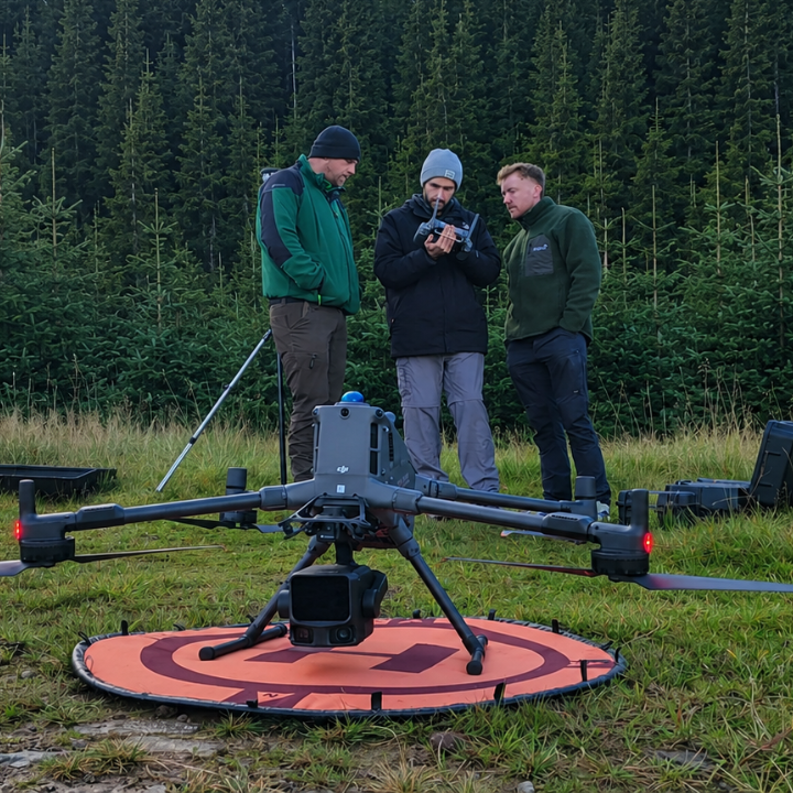
Aerial Surveying Training Course: Learning Outcomes
- Mission planning and date capture:
Plan efficient surveying missions for accurate data collection, and apply best practices for oblique, topographic, and manual drone surveys.
- GNSS positioning:
Understand NTRIP, base stations, rovers, and high-accuracy positioning workflows.
- Ground control:
Use ground control points (GCPs) and check points to improve survey accuracy.
- Photogrammetry and LiDAR:
Learn mapping techniques using photogrammetry and LiDAR technologies.
- Processing software:
Process survey data using DJI Terra, TerraSolid, and other industry-standard software.
- Data analysis and survey deliverables:
Clean, analyse, and calculate survey data, including volume measurements, and produce professional outputs including 2D orthomosaics and 3D models.

Full specifications
Manuals & documents
Customer reviews
“The Heliguy Survey Team were a pleasure to work with – professional, efficient, and clearly experienced in their field. They helped plan and carry out our drone survey with precision and made sure we got exactly the data we needed. Friendly service and clear communication from start to finish.”
Frequently asked questions
What will I learn on the drone survey course? What is the syllabus?⌄
The drone surveying course covers the complete surveying workflow, from mission planning and GNSS positioning to photogrammetry, LiDAR, data capture, processing, and analysis. You'll learn how to use ground control points, plan and fly survey missions, process data using software such as DJI Terra and TerraSolid, produce deliverables including 2D orthomosaics and 3D models, and complete a practical, scenario-based assessment. The syllabus is modular, allowing it to be tailored to your organisation's requirements.
| Module | Topics Covered | Delivery |
|---|---|---|
| Surveying Fundamentals | An Introduction to Surveying. Geodesy: Coordinate systems; Satellite positioning; Sources of positional corrections; Accuracy. | Classroom (theory) |
| GNSS Data Capture | Connecting to NTRIP, or base station. Rover data collection. Base station data collection. | Classroom and field (theory and practical) |
Who is the heliguy™ drone surveying course for?⌄
The heliguy™ drone surveying course is aimed at enterprise organisations who have recently adopted drones for surveying and want to benefit from expert support to help them realise the full potential of unmanned aircraft.
The heliguy™ aerial surveying course is delivered in a closed-course format, offering each organisation the chance to learn in an environment that is exclusive to them.
Please note that all participants of the heliguy™ drone surveying course must have a valid Operational Authorisation (part of the General Visual line of sight Certification).
How long is the heliguy™ drone surveying course?⌄
The heliguy™ drone surveying course is delivered over five days.
However, the syllabus is modular, meaning that each organisation can choose to complete certain modules - reducing the length of tuition and creating a tailored, application-specific course.
Where does the heliguy™ aerial surveying course take place?⌄
The heliguy™ drone surveying course is delivered by the heliguy™ instructors at the organisation's selected venue.
A suitable location(s) for delivery of the practical training must be arranged by the organisation receiving training.
Location information must be sent to the heliguy™ surveying team no later than 28 working days prior to the event if held within Controlled Airspace, and 14 working days if held within Uncontrolled Airspace. This is necessary in order to facilitate ATC/FIS approval to operate.
Is there an assessment at the end of the heliguy™ aerial surveying course?⌄
Yes: The heliguy™ aerial surveying course will feature a scenario-based practical assessment.
What happens on completion of the heliguy™ drone surveying course?⌄
On completion of the heliguy™ drone surveying course, participants will receive a certificate and a detailed workbook outlining operating procedures.
Do attendees need to be qualified drone pilots to attend the heliguy™ drone surveying course?⌄
Yes. Please note that all participants of the heliguy™ drone surveying course must have a valid Operational Authorisation, obtained as part of the GVC drone training course.
The GVC course can be completed with heliguy™.
Do pilots need to bring their own drones to the heliguy™ drone surveying course?⌄
heliguy™ will provide the drones for the aerial surveying course, and will aim to use like-for-like aircraft to that of the organisation. However, there may be occasions where the organisation's equipment may be used.
Common questions
- How long is the heliguy™ drone surveying course?
- Who is the heliguy™ drone surveying course for?
- What happens on completion of the Heliguy drone surveying course?
- What happens on completion of the heliguy™ drone surveying course?
- Do attendees need to be qualified drone pilots to attend the Heliguy drone surveying course?
- Do attendees need to be qualified drone pilots to attend the heliguy™ drone surveying course?