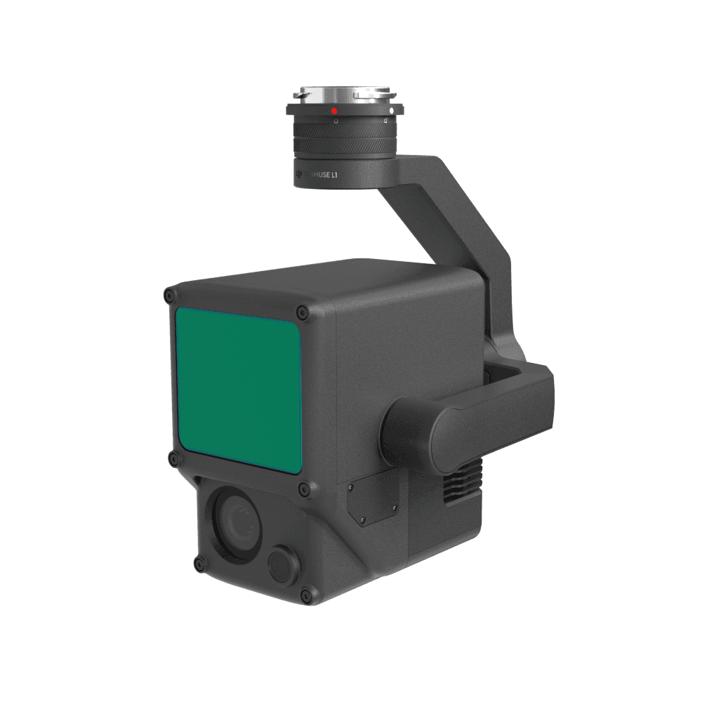
View 01 / 06Rental L1 LiDAR Payload
What you get in the box
01DJI Zenmuse L1 x 1
50-day return policy
  • Return within 50 days of purchase.
  • Full refund for unopened, sealed, unactivated items.
  • Opened products may still qualify if unused.
  • For orders over £100, we can arrange your return via DPD or in-person drop-off.
Next-day delivery — order before 3pm
  • Order before 3pm Mon–Fri for next-working-day delivery (free over £99).
  • UK Saturday delivery available on orders placed before 3pm Friday.
  • After 3pm Friday — dispatched Monday.
  • Some UK regions may need 2–3 working days.
Discounted options with main purchase
  • Bundle pricing on accessories, spares and training when bought together.
  • Reduced rates on add-ons selected at checkout.
  • Ask us for a tailored quote on multi-unit or fleet orders.

Rental L1 LiDAR Payload

£644 inc VAT weekly
Hire dates
Weeks
1
Return 15 Aug 2026 · 1 week, weekly hire only
Delivery & collection
Delivery & collectionCalculated at checkout
Upload your documents

Please upload the required information and documentation to complete your rental.

Proof of insuranceRecommended insurer is Coverdrone.Get insurance
I confirm and accept the £99 drone rental deposit, which will be added to cart automatically.
Hire · 1 week£644
Delivery & collection
Total (inc VAT)£644
heliguy hire

What do I need to book a rental?

Provide a few key documents, then enjoy your hire.

Insurance

Insure your rental under a hired-in (non-owned) equipment policy. We’ll need a certificate before your kit ships.

Flyer ID

Hold a valid CAA Flyer ID, plus an Operator ID covering the category of aircraft you’re hiring.

Proof of ID

After checkout, send a copy of your passport or driving licence so we can verify the booking.

Learn more about heliguy rental

Product dossier

Rental L1 LiDAR Payload

LiDAR and RGB Data collection

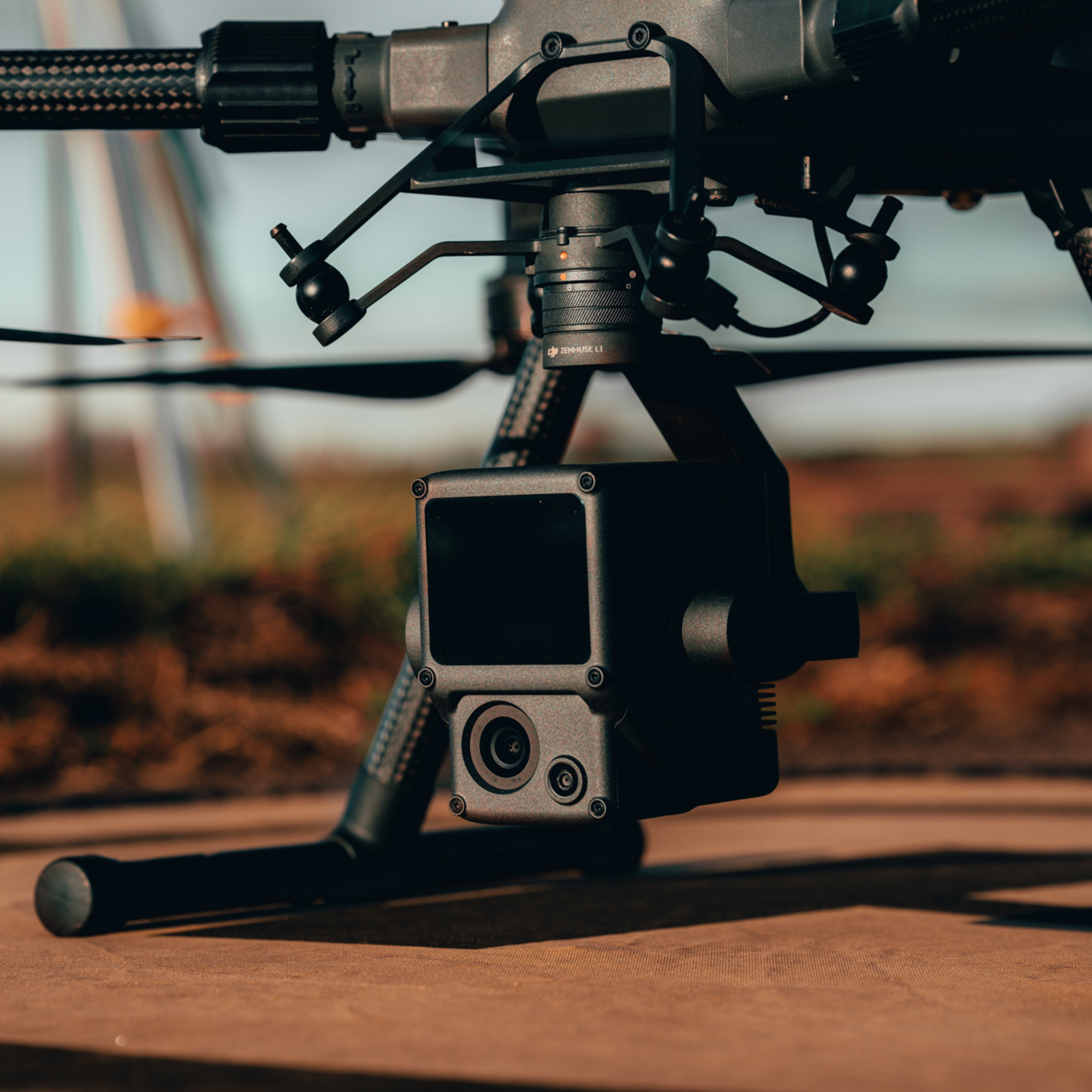
One Payload, Two Cameras

  • Comprehensive Imaging System:

    The Zenmuse L1 Combines the Livox LiDAR Module's high-precision point cloud capabilities with a 20MP RGB camera, providing detailed and accurate spatial data with effective detection, deep penetration, and high-quality imagery.

  • Livox LiDAR Module:

    Delivers up to 100% effective point cloud results with a 450m detection range and 240,000 points per second effective point cloud rate. Supports 3 returns and features both repetitive and non-repetitive scan modes for enhanced accuracy and deeper penetration.

  • RGB Camera:

    Equipped with a 20MP 1-inch sensor and a mechanical shutter for high-quality imaging and reduced motion blur.
One Payload, Two Cameras

Full specifications

Rental L1 LiDAR Payload
Specifications
SpecValue
Dimensions152 × 110 × 169 mm
Weight930±10 g
PowerTypical: 30 W; Max: 60 W
IP RatingIP54
Supported AircraftDJI M300 RTK, DJI 350 RTK
Operating Temperature Range-20° to 50° C (-4° to 122° F); 0° to 50° C (32° to 122° F) when using RGB mapping camera
Storage Temperature Range-20° to 60° C (-4° to 140° F)
Detection Range450 m @ 80% reflectivity, 0 klx; 190 m @ 10% reflectivity, 100 klx
Point RateSingle return: max. 240,000 pts/s; Multiple return: max. 480,000 pts/s
System Accuracy (RMS 1σ)Horizontal: 10 cm @ 50 m; Vertical: 5 cm @ 50 m / / This was achieved at 50 m flight altitude; flight speed 10 m/s; gimbal pitch -90°; and each straight segment of the flight route was less than 1,000 m.
Real-time Point Cloud Coloring ModesReflectivity, Height, Distance, RGB
Ranging Accuracy (RMS 1σ)3 cm @ 100 m* / *Measured in an environment of 25℃ with a target (80% reflectivity) 100 metres away. The result may vary under different test conditions.
Maximum Returns Supported3
Scan ModesNon-repetitive scanning pattern, Repetitive scanning pattern
FOVNon-repetitive scanning pattern: 70.4° (horizontal) × 77.2° (vertical); Repetitive scanning pattern: 70.4° (horizontal) × 4.5° (vertical)
Laser SafetyClass 1 (IEC 60825-1:2014) (Eye Safety)
IMU Update Frequency200 Hz
Accelerometer Range±8 g
Angular Velocity Meter Range±2000 dps
Yaw Accuracy (RMS 1σ)Real-time: 0.3°, Post-processing: 0.15°* / / *50 m flight altitude; flight speed 10 m/s; gimbal pitch -90°; and each straight segment of the flight route was less than 1,000 m; DJI Terra was used for post-processing.
Pitch / Roll Accuracy (RMS 1σ)Real-time: 0.05°, Post-processing: 0.025°* / / *50 m flight altitude; flight speed 10 m/s; gimbal pitch -90°; and each straight segment of the flight route was less than 1,000 m; DJI Terra was used for post-processing.
Resolution1280 × 960
FOV95°
Sensor Size1 inch
Effective Pixels20 MP
Photo Size5472 × 3078 (16:9); 4864 × 3648 (4:3); 5472 × 3648 (3:2)
Focal Length8.8 mm / 24 mm (Equivalent)
Shutter SpeedMechanical Shutter Speed: 1/2000 - 8 s Electronic Shutter Speed: 1/8000 - 8 s
ISOVideo: 100 – 3200 (Auto), 100 – 6400 (Manual) Photo: 100 - 3200 (Auto), 100 - 12800 (Manual)
Aperture Rangef/2.8 - f/11
Supported File SystemFAT (≤32 GB); exFAT (>32 GB)
Photo FormatJPEG
Video FormatMOV, MP4
Video ResolutionH.264, 4K: 3840×2160 30p
Gimbal/
Stabilised System3-axis (tilt, roll, pan)
Angular Vibration Range0.01°
MountDetachable DJI SKYPORT
Mechanical RangeTilt: -120° to +30°; Pan: ±320°
Operation ModesFollow/Free/Re-centre
Data Storage/
Raw Data StoragePhoto/IMU/Point cloud data storage/GNSS/Calibration files
Supported microSD CardsmicroSD: Sequential writing speed 50 MB/s or above and UHS-I Speed Grade 3 rating or above; Max capacity: 256 GB
Recommended microSD CardsSanDisk Extreme 128GB UHS-I Speed Grade 3 SanDisk Extreme 64GB UHS-I Speed Grade 3 SanDisk Extreme 32GB UHS-I Speed Grade 3 SanDisk Extreme 16GB UHS-I Speed Grade 3 Lexar 1066x 128GB U3 Samsung EVO Plus 128GB / / The recommended microSD cards may be updated in future.
Post-processing Software/
Supported SoftwareDJI Terra
Data FormatDJI Terra supports exporting standard format point cloud models: Point cloud format: PNTS/LAS/PLY/PCD/S3MB format

Manuals & documents

4 files

Frequently asked questions

Which drones are compatible with the L1?

The L1 is compatible with the DJI M350 RTK and DJI M300 RTK.

Can the L1 work at night?

The Lidar module of the L1 has active detection capability which can scan terrain to collect point clouds during nighttime or other low light conditions.

What is the IMU accuracy of the L1?

In typical operating scenarios, the IMU accuracy of the L1 is 0.025°(roll/pitch)/0.15°(yaw). The accuracy was measured under the following conditions in a DJI laboratory environment: After a 5-minute warm up, using Mapping Mission with Calibration Flight enabled in DJI Pilot, and with the RTK in FIX status. The relative altitude was set to 50 m, flight speed to 10 m/s, gimbal pitch to -90°, and each straight segment of the flight route was less than 1000 m. DJI Terra was used for post-processing.

How many returns does the L1 support?

The L1 supports 3 types of returns: One return; Two returns; Three returns.

What is the scanning frequency of the L1?

The L1 provides three scanning frequencies: One/two returns: 80K/s, 160K/s, and 240K/s; three returns: 80K/s, 240K/s. The L1 has two scanning modes: Non-repetitive Scanning mode and Repetitive Scanning mode.

What is the maximum measuring range of the L1?

The maximum measuring range of the L1 is 190m@10%, 100klx ; 450m@80%, 0klx. The recommended typical working height is 50m-120m.

What is the Field of View (FOV) of the L1's Lidar?

In Non-repetitive Scanning mode, the FOV is 70.4°x77.2°. In Repetitive Scanning mode, the FOV is 70.4°x4.5°.

Which model reconstruction formats does the L1 support?

The L1 supports the following model reconstruction formats:Point cloud formats: PNTS, LAS, PLY, PCD and S3MB.