50-day return policy⌄
- Return within 50 days of purchase.
- Full refund for unopened, sealed, unactivated items.
- Opened products may still qualify if unused.
- For orders over £100, we can arrange your return via DPD or in-person drop-off.
Next-day delivery — order before 3pm⌄
- Order before 3pm Mon–Fri for next-working-day delivery (free over £99).
- UK Saturday delivery available on orders placed before 3pm Friday.
- After 3pm Friday — dispatched Monday.
- Some UK regions may need 2–3 working days.
Discounted options with main purchase⌄
- Bundle pricing on accessories, spares and training when bought together.
- Reduced rates on add-ons selected at checkout.
- Ask us for a tailored quote on multi-unit or fleet orders.
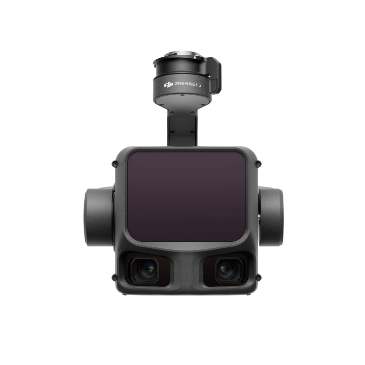
Rental DJI Zenmuse L3
Please upload the required information and documentation to complete your rental.
What do I need to book a rental?
Provide a few key documents, then enjoy your hire.
Insurance
Insure your rental under a hired-in (non-owned) equipment policy. We’ll need a certificate before your kit ships.
Flyer ID
Hold a valid CAA Flyer ID, plus an Operator ID covering the category of aircraft you’re hiring.
Proof of ID
After checkout, send a copy of your passport or driving licence so we can verify the booking.
Product dossier
Powerful drone LiDAR payload
DJI Zenmuse L3 key features
DJI's first long-range high-precision drone LiDAR payload.
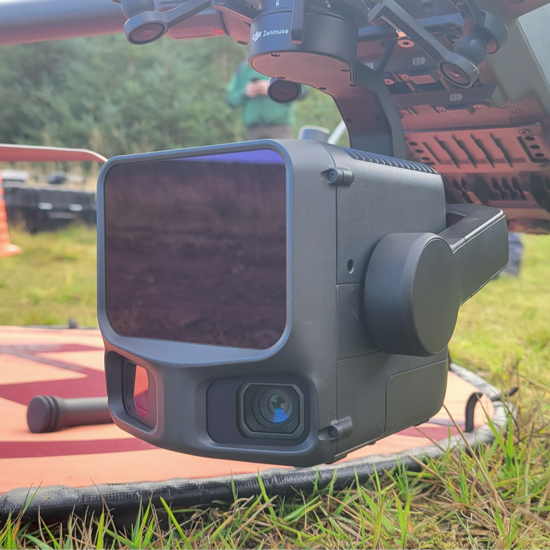
Integrates high-performance LiDAR, dual 100MP mapping cameras, and high-precision inertial navigation system.
Designed to improve accuracy, penetration, and range of laser point clouds.
Compatible with DJI M400: Purpose-built commpatibility for high-efficiency and long-range survey missions.
Use with DJI Terra and DJI Modify software platforms for an end-to-end solution.
3 scanning modes for mission versatility.
Full specifications
Manuals & documents
Frequently asked questions
What improvements does Zenmuse L3 have compared to the previous generation?⌄
DJI Zenmuse L3 offers a range of improvements on the DJI Zenmuse L2. These include: Hardware performance improvements: Zenmuse L3 delivers enhanced LiDAR performance. When measured at the same distance, Zenmuse L3 produces a laser spot about one-fifth the size of L2 and supports up to 16 returns. This means much stronger penetration capability, greater range, and higher ranging accuracy. The new dual 100MP RGB mapping camera system brings a horizontal FOV of up to 107°, compared to L2's 73.7°. POS accuracy is improved to 0.02° for heading, and 0.01° for roll and pitch. Accuracy and efficiency improvements: Zenmuse L3's vertical accuracy is better than 3 cm at 120m altitude, better than 5 cm at 300 m, and better than 10 cm at 500 m. The point cloud thickness produced by Zenmuse L3 is only half that of Zenmuse L2, supporting advanced analysis and high-accuracy applications. With a smaller laser spot and higher single-pulse energy, Zenmuse L3 offers superior penetration capability. In terrain mapping and similar applications, it captures more ground points with greater completeness, significantly improving the accuracy and integrity of terrain data for precise surface fitting and reconstruction. When mounted on DJI Matrice 400, Zenmuse L3 delivers outstanding efficiency. At a flight altitude of 300 m, a single flight can cover up to 10 km², enabling up to 100 km² of daily coverage. Find out more in our in-depth DJI Zenmuse L3 vs DJI Zenmuse L2 comparison blog.
What drone is compatible with the DJI Zenmuse L3?⌄
The DJI Zenmuse L3 is compatible with the DJI Matrice 400. It requires the use of the Zenmuse L3 single gimbal connector. Please ensure that the gimbal connector is connected to the E1 port on the aircraft's underside. Otherwise mapping accuracy will be reduced.
What is the protection level of DJI Zenmuse L3?⌄
DJI Zenmuse L3 can achieve an IP54 rating according to the IEC60529 standard under controlled laboratory conditions. To ensure the highest levels of protection: Before installing, make sure that the interface and surface of the gimbal are dry. Before use, make sure that the gimbal is firmly installed on the drone and the CFexpress™ card protective cap is clean, free of foreign objects, and closed. Before opening the CFexpress™ card protective cap, wipe the surface of the drone clean. The protection level will decrease over time due to normal device use and wear.
What is the laser pulse emission frequency of Zenmuse L3? How many returns does it support?⌄
The DJI Zenmuse L3 offers the following laser pulse emission frequency: 4, 8, 16 returns (100 kHz, 350 kHz). 4, 8 returns (1000 kHz). 4 returns (2000 kHz).
How many scanning modes does Zenmuse L3 have? In what scenarios do they apply?⌄
DJI Zenmuse L3 supports Linear, Star-Shaped, and Non-Repetitive scanning modes for different operational scenarios: Linear: Achieves more consistent point cloud distribution, ideal for high-accuracy terrain mapping. Star-Shaped: Balances accuracy with multiple scan angles and penetration capability, well-suited for forests or dense urban environments. Non-Repetitive: Provides multiple scan angles and broader coverage, optimized for transmission tower reconstruction and other complex structural surveys.
How does the range of DJI Zenmuse L3 change at different laser pulse emission frequencies?⌄
The range of the DJI Zenmuse L3 is as follows: 290 m (centre), 200 m (edge)@10% reflectivity, 2000 kHz, recommended operating altitude ≤ 50 m. 400 m (centre), 280 m (edge)@10% reflectivity, 1000 kHz, recommended operating altitude ≤ 100 m. 700 m (centre), 500 m (edge)@10% reflectivity, 350 kHz, recommended operating altitude ≤ 300 m. 950 m (centre), 650 m (edge)@10% reflectivity, 100 kHz, recommended operating altitude ≤ 500 m.
What is the DJI Zenmuse L3's dual 100MP RGB mapping camera system for?⌄
The dual RGB mapping camera system on the DJI Zenmuse L3 expands the horizontal FOV to 107°, enabling each acquisition to cover a broader area. Even with a 20% LiDAR side overlap ratio, you can capture data for both digital orthophoto maps (DOM) and digital elevation models (DEM) in a single flight, thereby greatly improving operational efficiency.
What is the difference between 100MP and 25MP operation when using the DJI Zenmuse L3? Which scenarios are each suitable for?⌄
The difference between 100MP and 25MP operation on the DJI Zenmuse L3, when deploying the dual camera system, is as follows: 100MP (High Resolution): Provides more pixels and finer image detail, though it requires more storage space. At the same ground sample distance (GSD), it allows for higher flight altitudes and is recommended for operations above 150 m. 25MP (High Sensitivity): Features larger equivalent pixel size, better signal-to-noise ratio, and higher sensitivity. It requires less storage and, for the same GSD, necessitates lower flight altitudes, making it suitable for operations at or below 150 m.
Common questions
- What drone is compatible with the DJI Zenmuse L3?
- What is the protection level of DJI Zenmuse L3?
- What improvements does Zenmuse L3 have compared to the previous generation?
- Can the Zenmuse L3 be used for carbon and biomass analysis?
- How many scanning modes does Zenmuse L3 have? In what scenarios do they apply?
- What is the DJI Zenmuse L3's dual 100MP RGB mapping camera system for?