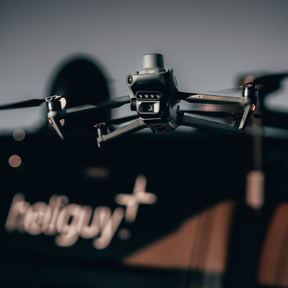
Aircraft
Net Weight (with propellers and RTK module)951 g
Max Takeoff Weight1,050 g
Dimensions (Folded/Unfolded)Folded (without propellers): 223 x 96.3 x 122.2 mm (Length x Width x Height) / Unfolded (without propellers): 347.5 x 283 x 139.6 mm (Length x Width x Height)
Diagonal LengthDiagonal: 380.1 mm
Max Ascent Speed6 m/s (Normal Mode) / 8 m/s (Sport Mode)
Max Descent Speed6 m/s (Normal Mode) / 6 m/s (Sport Mode)
Max Flight Speed (at sea level, no wind)15 m/s (Normal Mode) / Flying forward: 21 m/s, flying sideways: 20 m/s, flying backwards: 19 m/s (Sport mode) / *The max speed in the EU cannot exceed 19 m/s.
Max Wind Speed Resistance12 m/s / *Max wind resistance during takeoff and landing.
Max Take-off Altitude Above Sea Level6000 m (without a payload)
Max Flight Time (without wind)43 minutes / *Data measured using the DJI Mavic 3M in a wind-free environment while flying at sea level at a constant speed of 36 kph until there was 0% power remaining. For reference only. Please pay attention to Return to Home prompts in the DJI Pilot 2 app when flying.
Max Hover Time (without wind)37 minutes / *Data measured using the DJI Mavic 3M in a wind-free environment while flying at sea level at a constant speed of 36 kph until there was 0% power remaining. For reference only. Please pay attention to Return to Home prompts in the DJI Pilot 2 app when flying.
Max Flight Distance32 km / *Data measured using the DJI Mavic 3M in a wind-free environment while flying at sea level at 57.6 kph until there was 0% power remaining. For reference only. Please pay attention to Return to Home prompts in the DJI Pilot 2 app when flying.
Max Tilt Angle30° (Normal Mode) / 35° (Sport Mode)
Max Angular Velocity200°/s
GNSSGPS + Galileo + BeiDou + GLONASS (GLONASS is supported only when RTK module is enabled)
Hovering Accuracy RangeVertical: ±0.1 m (Vision Positioning enabled); ±0.5 m (GNSS Positioning enabled); ±0.1 m (D-RTK enabled) / Horizontal: ±0.3 m (Vision Positioning enabled); ±0.5 m (HD Positioning enabled); ±0.1 m (RTK enabled)
Operating Temperature-10° to 40° C (14° to 104° F)
Internal StorageN/A
Motor Model Number2008
Propeller Model Number9453F Enterprise Edition
Light SensorBuilt-in module
RGB Camera
Image Sensor4/3 CMOS / Effective Pixels: 20 MP
LensFOV: 84° / Equivalent focal length: 24 mm / Aperture: f/2.8 to f/11 / Focus: 1 m to ∞
ISO Range100-6400
Shutter speedElectronic shutter: 8-1/8000 s / Mechanical shutter: 8-1/2000 s
Max Image Size5280 x 3956
Photo Shooting ModeSingle shot: 20 MP / Timelapse: 20 MP / JPEG: 0.7/1/2/3/5/7/10/15/20/30/60 s / JPEG + RAW: 3/5/7/10/15/20/30/60 s / Panorama: 20 MP (original material)
Video ResolutionH.264: / 4K: 3840 x 2160@30fps / FHD: 1920 x 1080@30fps
Max Video Bitrate4K: 130Mbps / FHD: 70Mbps
Supported File SystemexFAT
Image FormatJPEG/DNG (RAW)
Video FormatMP4 (MPEG-4 AVC/H.264)
Multispectral Camera
Image Sensor1/2.8-inch CMOS, effective pixels: 5 MP
LensFOV: 73.91° (61.2° x 48.10°) / Equivalent focal length: 25 mm / Aperture: f/2.0 / Focus: Fixed Focus
Multispectral Camera BandGreen (G): 560 ± 16 nm; / Red (R): 650 ± 16 nm; / Red Edge (RE): 730 ± 16 nm; / Near infrared (NIR): 860 ± 26 nm;
Gain Range1x-32x
Shutter SpeedElectronic Shutter: 1/30~1/12800 s
Max Image Size2592 x 1944
Image FormatTIFF
Video FormatMP4 (MPEG-4 AVC/H.264)
Photo Shooting ModeSingle shot: 5 MP / Timelapse: 5 MP / TIFF: 2/3/5/7/10/15/20/30/60 s
Video ResolutionH.264 / FHD: 1920 x 1080@30fps / Video content: NDVI/GNDVI/NDRE
Max Video BitrateStream: 60 Mbps
Gimbal
Stabilisation System3-axis mechanical gimbal (tilt, roll, pan)
Mechanical RangeTilt: -135° to 45° / Roll: -45° to 45° / Pan: -27° to 27°
Controllable RangeTilt: -90° to 35° / Pan: Uncontrollable
Max Control Speed (tilt)100°/s
Angular Vibration Range±0.007°
Sensing System
Sensing System TypeOmnidirectional binocular vision system, with an infrared sensor at the bottom of the aircraft
ForwardDistance Measuring Range: 0.5 m to 20 m / Detection Range: 0.5 m to 200 m / Effective Obstacle Avoidance Speed: Flight Speed ≤15 m/s / FOV: Horizontal 90°, vertical 103°
BackwardDistance Measuring Range: 0.5 m to 16 m / Effective Obstacle Avoidance Speed: Flight speed ≤12 m/s / FOV: Horizontal 90°, vertical 103°
LateralDistance Measuring Range: 0.5 m to 25 m / Effective Obstacle Avoidance Speed: Flight speed ≤15 m/s / FOV: Horizontal 90°, vertical 85°
UpwardDistance Measuring Range: 0.2 m to 10 m / Effective Obstacle Avoidance Speed: Flight Speed ≤6 m/s / FOV: Front and rear 100°, left and right 90°
DownwardDistance Measuring Range: 0.3 m to 18 m / Effective Obstacle Avoidance Speed: Flight speed ≤6 m/s / FOV: Front and rear 130°, left and right 160°
Operating EnvironmentFront, Rear, Left, Right, Above: Surfaces with clear patterns and adequate lighting (> 15 lux, environments with normal indoor fluorescent light exposure) / Below: Surfaces with diffuse reflection material and a reflectivity of >20% (such as walls, trees, people, etc.); Adequate lighting (>15 lux, environments with normal indoor fluorescent light exposure)
Video Transmission
Video Transmission SystemDJI O3 Image Transmission Industry Edition
Live View QualityRemote Controller: 1080p/30fps
Operating Band2.400-2.4835 GHz / 5.725-5.850 GHz / *In some countries, the 5.1/5.8GHz frequencies are prohibited, or the 5.1GHz frequency is only allowed for indoor use. Please refer to local laws and regulations before use.
Max Effective Signal Distance (Unobstructed, No interference)FCC: 15 km / CE: 8 km / SRRC: 8 km / MIC: 8 km / *Data measured flying in an unobstructed outdoor environment free of interference. It shows the farthest communication range for one-way, non-Return to Home flights under each standard. Please pay attention to Return to Home prompts in the DJI Pilot 2 app when flying.
Max Transmission Distance (Obstructed)Strong Interference (urban landscapes, residential areas, etc.): 1.5-3 km (FCC/CE/SRRC/MIC) / Medium Interference (suburban landscapes, city parks, etc.): 3-9 km (FCC), 3-6 km (CE/SRRC/MIC) / Weak Interference (remote fields, open farmland, etc.): 9-15 km (FCC), 6-8 km (CE/SRRC/MIC) / *Data measured in an unobstructed environment with typical interference under various standards. The actual flight distance may vary and is for reference only.
Max Download Speed15 MB/s (with DJI RC Pro Industry Edition)
Latency (depending on environment and mobile device)Approximately 200 milliseconds
Antennas4 antennas, 2 transmitting and 4 receiving
Transmitter Power (EIRP)2.4 GHz: <33 dBm (FCC), <20 dBm (CE/SRRC/MIC) / 5.8 GHz: <33 dBm (FCC), <30 dBm (SRRC), <14 dBm (CE)
OtherSupports the DJI Cellular module
DJI RC Pro Enterprise Edition
Image Transmission SystemDJI O3 Image Transmission Industry Edition
Max Effective Signal Distance (Unobstructed, No interference)FCC: 15 km / CE: 8 km / SRRC: 8 km / MIC: 8 km / *Data measured flying in an unobstructed outdoor environment free of interference. It shows the farthest communication range for one-way, non-Return to Home flights under each standard. Please pay attention to Return to Home prompts in the DJI Pilot 2 app when flying.
Operating Band of Image Transmission2.400-2.4835 GHz / 5.725-5.850 GHz / *In some countries, the 5.1/5.8GHz frequencies are prohibited, or the 5.1GHz frequency is only allowed for indoor use. Please refer to local laws and regulations before use.
Antennas4 antennas, 2 transmitting and 4 receiving
Operating Band of Image Transmission and Transmitter Power (EIRP)2.4 GHz: <33 dBm (FCC); <20 dBm (CE/SRRC/MIC) / 5.8 GHz: <33 dBm (FCC); <14 dBm (CE); <23 dBm (SRRC) /
Wi-Fi Protocol802.11 a/b/g/n/ac/ax / Support 2×2 MIMO Wi-Fi
Wi-Fi Operating Band2.400-2.4835 GHz / 5.150-5.250 GHz / 5.725-5.850 GHz / *In some countries, the 5.1/5.8GHz frequencies are prohibited, or the 5.1GHz frequency is only allowed for indoor use. Please refer to local laws and regulations before use.
Wi-Fi Operating Band and Transmitter Power (EIRP)2.4 GHz: <26 dBm (FCC); <20 dBm (CE/SRRC/MIC) / 5.1 GHz: <26 dBm (FCC); <23 dBm (CE/SRRC/MIC) / 5.8 GHz: <26 dBm (FCC/SRRC); <14 dBm (CE)
Bluetooth ProtocolBluetooth 5.1
Bluetooth Operating Band2.400-2.4835 GHz
Bluetooth Transmitter Power (EIRP)<10 dBm
Screen Resolution1920 x 1080
Screen Size5.5 inches
Screen Frame Rate60 fps
Screen Brightness1,000 nits
Touch-Screen10-point multi-touch
BatteryLithium-ion battery (5000 mAh, 7.2 V)
Charging Type100W Battery Charging Hub or USB charger with 12V or 15V specifications is recommended
Rated Power12 Watts
Storage CapacityInternal Memory (ROM): 64 GB / Supports microSD card usage to increase storage capacity
Charging TimeApprox. 1.5 hours (measured when only using the 100W Battery Charging Hub to charge the remote control, or when using a 15V USB charger) / Approximately 2 hours (measured using a 12V USB charger) / Approximately 2 hours and 50 minutes (measured using the 100W Battery Charging Hub to charge the aircraft and remote control at the same time)
Operating TimeApprox. 3 hours
Video Output PortMini-HDMI Port /
Operating Temperature-10° to 40° C (14° to 104°F)
Storage Temperature Range<1 month: -30° to 60° C (-22° to 140° F) / One to three months: -30° to 45° C (-22° to 113° F) / Three to six months: -30° to 35° C (-22° to 95° F) / More than six months: -30° to 25° C (-22° to 77° F)
Charging Temperature5° to 40° C (41° to 104° F)
Supported DJI AircraftDJI Mavic 3E / DJI Mavic 3T / DJI Mavic 3M / *Further drones to be supported in the future
GNSSGPS + Galileo + GLONASS
DimensionsAntenna is folded and no control sticks are installed: / 183.27 x 137.41 x 47.6 mm (Length x Width x Height) / Antenna unfolded and control sticks are installed: / 183.27 × 203.35 × 59.84 mm (Length x Width x Height)
WeightApprox. 680 g
Model NumberRM510B
Storage
Supported microSD CardsAircraft: / Please use a memory card with a speed rating of V30 or higher, or use a memory card from the recommended list
Recommended microSD CardsRemote Controller: / SanDisk Extreme PRO 64GB V30 A2 microSDXC / SanDisk High Endurance 64GB V30 microSDXC / SanDisk Extreme 128GB V30 A2 microSDXC / SanDisk Extreme 256GB V30 A2 microSDXC / SanDisk Extreme 512GB V30 A2 microSDXC / Lexar 667x 64GB V30 A2 microSDXC / Lexar High-Endurance 64GB V30 microSDXC / Lexar High-Endurance 128GB V30 microSDXC / Lexar 667x 256GB V30 A2 microSDXC / Lexar 512GB V30 A2 microSDXC / Samsung EVO Plus 64GB V30 microSDXC / Samsung EVO Plus 128GB V30 microSDXC / Samsung EVO Plus 256GB V30 microSDXC / Samsung EVO Plus 512GB V30 microSDXC / Kingston Canvas Go! Plus 128GB V30 A2 microSDXC / Kingston Canvas React Plus 128GB V90 A1 microSDXC / / Aircraft: / SanDisk Extreme 32GB V30 A1 microSDHC / SanDisk Extreme PRO 32GB V30 A1 microSDHC / SanDisk Extreme 512GB V30 A2 microSDXC / Lexar 1066x 64GB V30 A2 microSDXC / Kingston Canvas Go! Plus 64GB V30 A2 microSDXC / Kingston Canvas React Plus 64GB V90 A1 microSDXC / Kingston Canvas Go! Plus 128GB V30 A2 microSDXC / Kingston Canvas React Plus 128GB V90 A1 microSDXC / Kingston Canvas React Plus 256GB V90 A2 microSDXC / Samsung PRO Plus 256GB V30 A2 microSDXC
Battery
Capacity5000 mAh
Standard Voltage15.4 V
Max Charging Voltage17.6 V
Battery TypeLiPo 4S
Chemical SystemLithium Cobalt
Energy77 watt-hours
Weight335.5 g
Charging Temperature5° to 40° C (41° to 104° F)
Battery Charger
Input100V to 240V (AC), 50Hz to 60Hz, 2.5A
Output Power100 Watts
OutputMaximum output power of 100 Watts (total) / When both the ports are used, the maximum output power of one interface is 82 W, and the charger will dynamically allocate the output power of the two interfaces according to load power.
Charging Hub
InputUSB-C: 5V to 20V, 5.0A
OutputBattery Port: 12V to 17.6V, 8.0A
Rated Power100 Watts
Charging Type3 batteries on charging rotation
Charging Temperature5° to 40° C (41° to 104° F)
RTK Module
Dimensions50.2 x 40.2 x 66.2 mm (Length x Width x Height) /
Weight24±2 g
InterfaceUSB-C
PowerApproximately 1.2 watts
RTK Position AccuracyFixed RTK: / Horizontal: 1 cm + 1 ppm; Vertical: 1.5 cm + 1 ppm