50-day return policy⌄
- Return within 50 days of purchase.
- Full refund for unopened, sealed, unactivated items.
- Opened products may still qualify if unused.
- For orders over £100, we can arrange your return via DPD or in-person drop-off.
Next-day delivery — order before 3pm⌄
- Order before 3pm Mon–Fri for next-working-day delivery (free over £99).
- UK Saturday delivery available on orders placed before 3pm Friday.
- After 3pm Friday — dispatched Monday.
- Some UK regions may need 2–3 working days.
Discounted options with main purchase⌄
- Bundle pricing on accessories, spares and training when bought together.
- Reduced rates on add-ons selected at checkout.
- Ask us for a tailored quote on multi-unit or fleet orders.
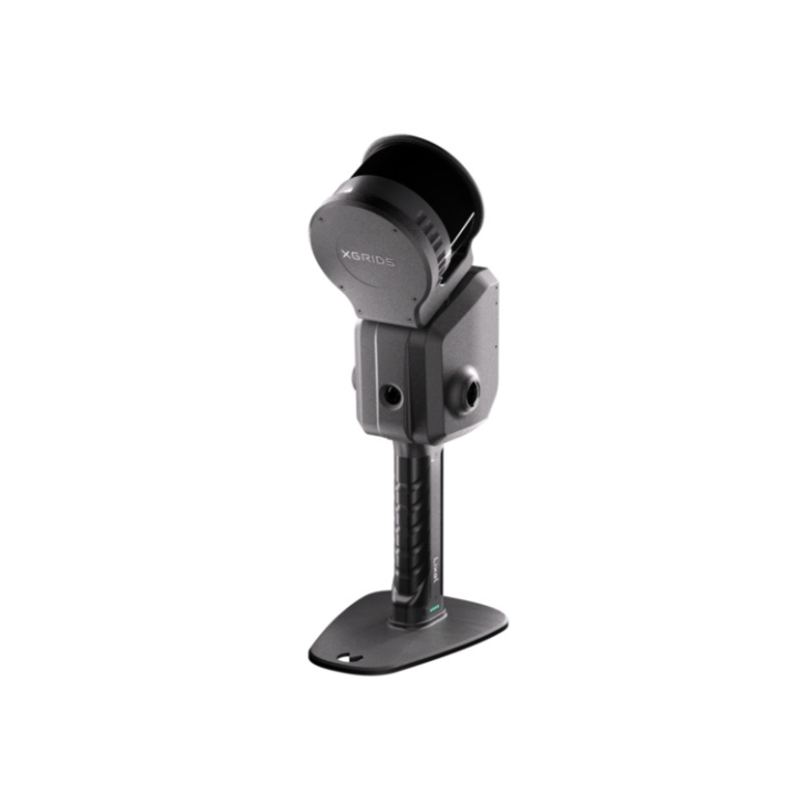
Rental XGRIDS L2 Pro (32 Channel 120m)
Please upload the required information and documentation to complete your rental.
What do I need to book a rental?
Provide a few key documents, then enjoy your hire.
Insurance
Insure your rental under a hired-in (non-owned) equipment policy. We’ll need a certificate before your kit ships.
Flyer ID
Hold a valid CAA Flyer ID, plus an Operator ID covering the category of aircraft you’re hiring.
Proof of ID
After checkout, send a copy of your passport or driving licence so we can verify the booking.
Product dossier
Versatile handheld laser scanner
Lixel L2 Pro Key Features
- Fully-Integrated:
This all-in-one sensor features a rotating LiDAR module, dual 48MP panoramic cameras (removing the need for external cameras), high-precision 6DOF IMU, and multi-SLAM to maximise performance.
- Reality Capture:
Use with Lixel CyberColor to create Gaussian Splats for reality capture.
- Real-time True-colour Outputs:
Obtain photo-quality true-colour point clouds in real-time. These real-time outputs rival other sensors' post-processing quality.
- Dense Point Clouds:
1 million points/㎡ with 1mm spacing for dense point clouds and 5mm point cloud thickness for more accurate mapping and line drawing.
- Map In Complex Environments:
Multi-SLAM algorithms enhance adaptability and reliability in challenging and complex environments. Ideal for mapping indoors, underground, or in structures like subways and tunnels.
- Accessory Ecosystem:
Combine with an Extension Pole, RTK Module, Phone Mount, or Supporting Harness to enhance usability and flexibility.

Full specifications
Manuals & documents
Frequently asked questions
What levels of accuracy can be achieved with the Lixel L2 Pro?⌄
The Lixel L2 Pro can obtain high-precision real-time data featuring: Real-time Absolute Accuracy: 3cm* Relative Accuracy: 1cm** Horizontal and Vertical Accuracy: 0.015° Repeatability: 2cm *The disconnection distance of the control point/RTK is less than 100m **The distance between the two points is less than 100m
Common questions
- Can the XGRIDS Lixel L2 Pro be drone mounted?
- What channels does the XGRIDS L2 Pro Survey Grade Kit support?
- Which drones are compatible with the XGRIDS L2 Pro Drone Mounting Bracket?
- Can I use the XGRIDS L2 Pro Extension Pole Kit with any other models?
- Can I use the XGRIDS L2 Pro Mobile Phone Mount Kit with any other models?
- What is the accuracy of the XGRIDS L2 Pro when used with the drone mount?