50-day return policy⌄
- Return within 50 days of purchase.
- Full refund for unopened, sealed, unactivated items.
- Opened products may still qualify if unused.
- For orders over £100, we can arrange your return via DPD or in-person drop-off.
Next-day delivery — order before 3pm⌄
- Order before 3pm Mon–Fri for next-working-day delivery (free over £99).
- UK Saturday delivery available on orders placed before 3pm Friday.
- After 3pm Friday — dispatched Monday.
- Some UK regions may need 2–3 working days.
Discounted options with main purchase⌄
- Bundle pricing on accessories, spares and training when bought together.
- Reduced rates on add-ons selected at checkout.
- Ask us for a tailored quote on multi-unit or fleet orders.
XGRIDS Lixel K2
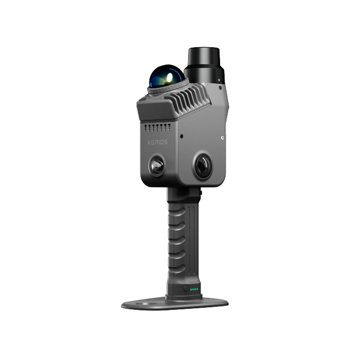
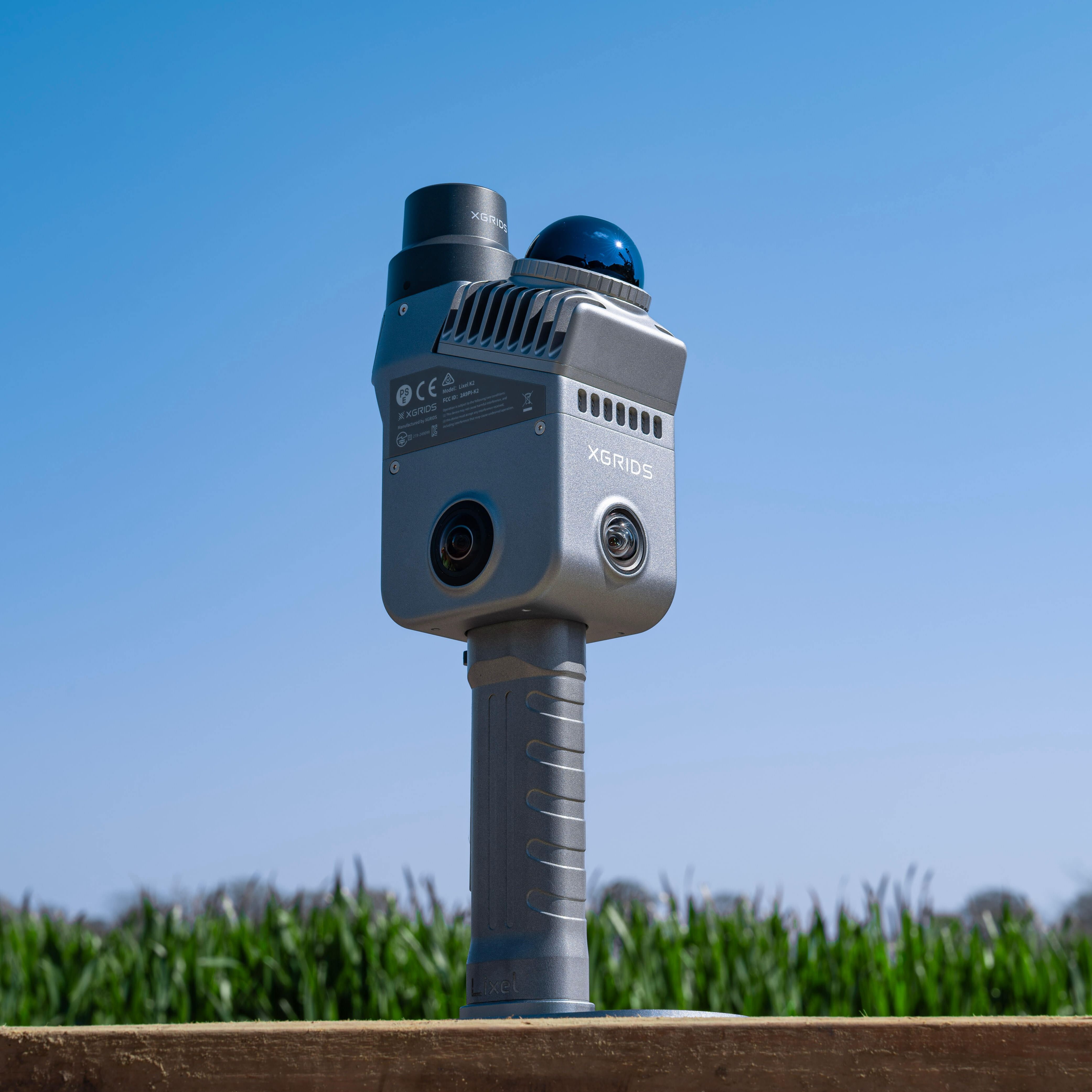
XGRIDS Lixel K2 is a lightweight and compact handheld scanner for true-colour point clouds and 3DGS reality capture models.
heliguy support & optional extras
Product dossier
The gold standard in lightweight scanning
XGRIDS Lixel K2 key features
Compact scanner (1.2kg) for streamlined, on-the-go mobile mapping.
Up to 1 cm accuracy for measurement-ready data.
~1 cm point cloud thickness for clean, usable outputs.
Real-time point cloud generation during capture.
True-to-life colour and structural detail.
Flexible outputs: Real-time point cloud, post-processed point cloud, mesh, and 3DGS.
Full specifications
Frequently asked questions
What is the XGRIDS Lixel K2 used for?⌄
The Lixel K2 is a lightweight 3D spatial scanner used to capture accurate, measurement-ready data for applications including surveying, construction, public safety, inspection, heritage preservation, and digital twin creation.
It can also be used to capture data for high-fidelity 3DGS (3D Gaussian Splatting) outputs.
View XGRIDS handheld scanner ecosystem
XGRIDS Lixel K2 vs Lixel K1: What is the difference? What upgrades does the Lixel K2 have?⌄
The XGRIDS Lixel K2 builds upon the success of the Lixel K1 and is equipped with some key upgrades. These include:
• Lixel K2 runs a more capable multi-SLAM real-time spatial perception system
• Lixel K2 has an integrated RTK module to lock-in spatial coordinates.
• Lixel K2 has a forward-facing camera to capture more of the scene in one pass.
• Lixel K2 has 512GB of internal storage. K1 has no internal storage, supporting a 256GB microSD card.
• Lixel K2 offers enhanced relative accuracy: 1cm vs 1.2cm.
• Lixel K2 is more cost-effective than the Lixel K1.
View XGRIDS handheld scanner ecosystem
How accurate is the XGRIDS Lixel K2?⌄
The XGRIDS Lixel K2 delivers up to 1 cm accuracy, making it suitable for engineering-grade measurement tasks such as capturing walls, openings, and structural dimensions.
View XGRIDS handheld scanner ecosystem
What is the measurement range and scan speed of the XGRIDS Lixel K2?⌄
The XGRIDS Lixel K2 has a scan range of up to 100 metres (≥40 m at 10% reflectivity) and captures data at 200,000 points per second.
This enables fast, efficient capture of both indoor and large-scale environments, while maintaining accurate and detailed point cloud data.
View XGRIDS handheld scanner ecosystem
What makes K2 different from other handheld scanners?⌄
The XGRIDS Lixel K2 combines high accuracy, thin point clouds (~1 cm), real-time capture, and 3DGS outputs in a lightweight device. It also integrates into a complete ecosystem, enabling a full scan-to-delivery workflow.
View XGRIDS handheld scanner ecosystem
What is 3DGS and how does the XGRIDS Lixel K2 use it?⌄
3D Gaussian Splatting (3DGS) is an advanced method for creating highly realistic, immersive 3D environments.
The XGRIDS Lixel K2 uses this technology via Lixel CyberColor to produce visually rich models with smaller file sizes and smooth performance across devices, including mobile and VR.
View XGRIDS handheld scanner ecosystem
What outputs does the K2 support?⌄
The XGRIDS Lixel K2 supports multiple output formats, including:
• Point clouds (.las)
• Mesh models
• Immersive 3DGS models
This allows you to adapt your data to a wide range of workflows and applications.
View XGRIDS handheld scanner ecosystem
Does K2 provide real-time data during scanning?⌄
Yes, the XGRIDS Lixel K2 generates real-time, true-colour point clouds as you scan, allowing for immediate validation, measurement, and remote sharing.
View XGRIDS handheld scanner ecosystem
Common questions
- How accurate is the XGRIDS Lixel K2?
- XGRIDS Lixel K2 vs Lixel K1: What is the difference? What upgrades does the Lixel K2 have?
- What is the XGRIDS Lixel K2 used for?
- How does the XGRIDS Lixel K2 improve workflow efficiency?
- What is 3DGS and how does the XGRIDS Lixel K2 use it?
- What is the measurement range and scan speed of the XGRIDS Lixel K2?