50-day return policy⌄
- Return within 50 days of purchase.
- Full refund for unopened, sealed, unactivated items.
- Opened products may still qualify if unused.
- For orders over £100, we can arrange your return via DPD or in-person drop-off.
Next-day delivery — order before 3pm⌄
- Order before 3pm Mon–Fri for next-working-day delivery (free over £99).
- UK Saturday delivery available on orders placed before 3pm Friday.
- After 3pm Friday — dispatched Monday.
- Some UK regions may need 2–3 working days.
Discounted options with main purchase⌄
- Bundle pricing on accessories, spares and training when bought together.
- Reduced rates on add-ons selected at checkout.
- Ask us for a tailored quote on multi-unit or fleet orders.
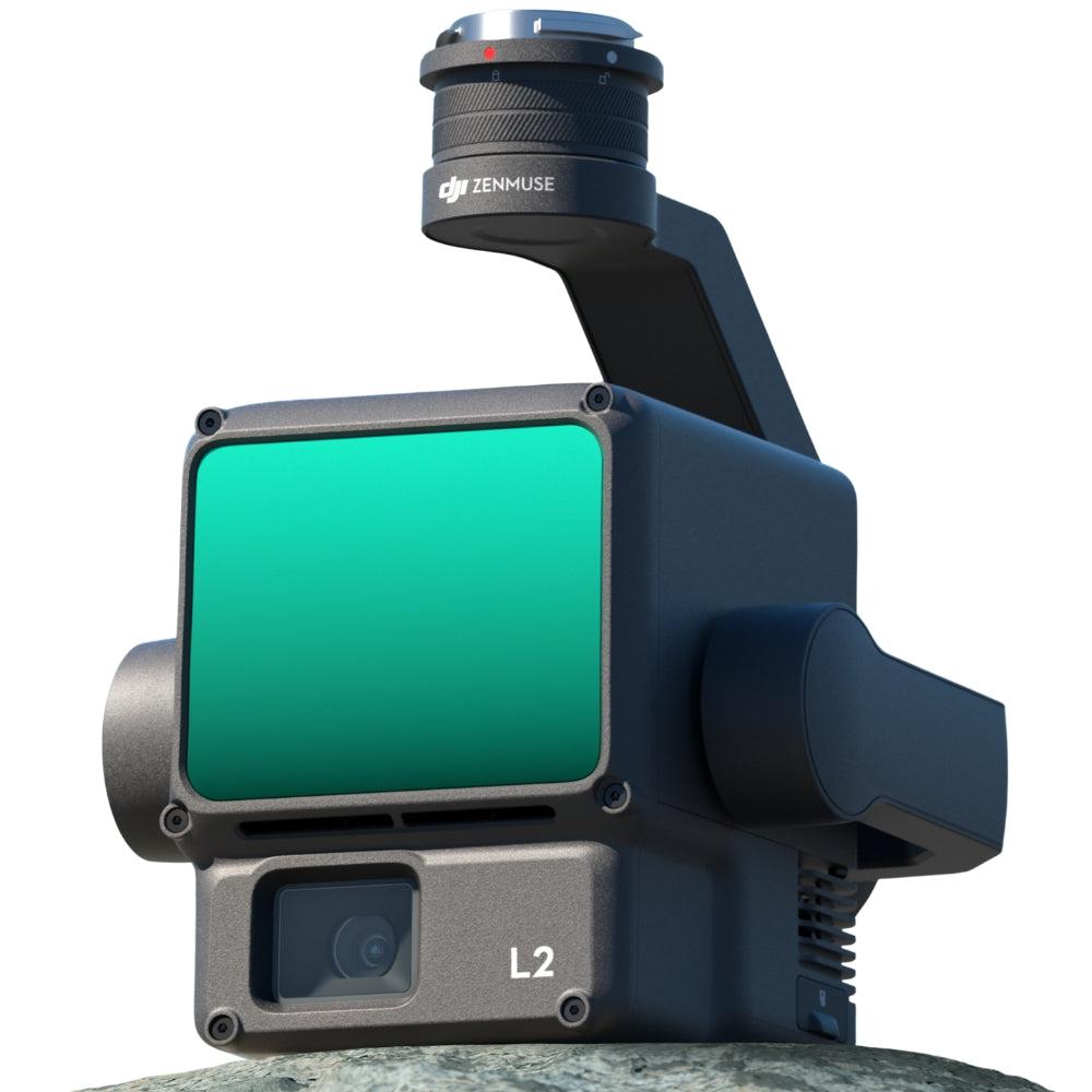
DJI Zenmuse L2
A precise and efficient drone surveying payload with a LiDAR module, high-accuracy IMU, RGB camera, and 3-axis gimbal.
heliguy support & optional extras
Product dossier
Advanced Detection and Scanning Performance
DJI Zenmuse L2 Key Features
- Detection Range:
450m @ 50% reflectivity, 0klx; 250m @ 10% reflectivity, 100klx.
- Point Cloud Rate:
Single Return Max - 240,000 pts/s. Multiple returns, max 1,200,000 pts/s.
- Scanning Modes:
L2 has non-repetitive scanning pattern and repetitive scanning pattern. This increases the likelihood of objects and other details being detected within the FOV.
5 Returns: Up to 5 returns @ 240kHz.
- More Concentrated Energy:
Smaller beam size - laser spot size is 4 x 12cm @ 100m, 1/5th of the L1.
- Highly Accurate:
Horizontal 5cm @ 150m flight altitude; Vertical: 4cm @ 150m flight altitude.
- Efficient:
Collect data while flying at up to 15m/s. Cover up to 2.5km-squared in a single flight.
Full specifications
Watch it in action
Manuals & documents
Customer reviews
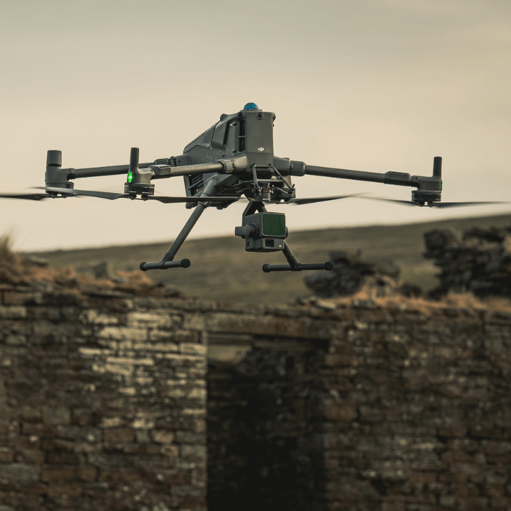
“I recently used the DJI Zenmuse L2 on my construction site to collect some LiDAR data and was seriously impressed by the accuracy and detail it delivered. It was easy to set up, simple to operate, and worked brilliantly with our M300 RTK. The Heliguy staff were approachable, knowledgeable, and really helpful throughout the process.”
“I never write reviews but this company certainly deserves it. top-quality service I received from Richard in my recent transaction but HeliGuy as a whole from previous transactions - faultless from start to finish! Everything arrived in a timely manner, and I’m genuinely excited to get started with it. Thanks again for making the whole process so smooth — really appreciate it.”
Frequently asked questions
What is DJI Care Enterprise and what options are available?⌄
DJI Care Enterprise offers comprehensive protection for your DJI Enterprise drone fleet. Two packages are available: DJI Care Enterprise Plus and DJI Care Enterprise Basic.
It provides DJI Enterprise products with coverage for a range of accidental damages, such as collisions, water damage, and misoperation. DJI Care Enterprise Plus also covers flyaways.
The table below shows the benefits of DJI Care Enterprise Plus vs DJI Care Enterprise Basic.
| DJI Care Enterprise Plus | DJI Care Enterprise Basic | |
|---|---|---|
| Service model | Unlimited free repairs within the coverage limit | Affordable replacements |
| Service quantity | No limit | Twice a year |
| Service charge | Free repairs | Low-cost replacement |
| Coverage for your whole fleet | DJI Enterprise products bound to DJI Care Enterprise Plus at the same period ( within 30 days ) can share the total coverage | - |
| Turnaround time | Prioritised repair | DJI Care Express |
| Flyaway coverage | 1 flyaway per year. Supported aircraft: DJI Matrice 30, DJI Matrice 30T, DJI Mavic 3 Enterprise, DJI Mavic 3 Thermal, DJI Mavic 3 Thermal Advanced, DJI Mavic 3 Multispectral, DJI Matrice 4T. DJI Matrice 4E. Flyaway fee applies. | - |
| Factory maintenance | 1 factory maintenance per year. Supported aircraft: DJI Matrice 30, DJI Matrice 30T, DJI Matrice 30T Dock Version, DJI Mavic 3 Enterprise, DJI Mavic 3 Thermal, DJI Mavic 3 Thermal Advanced, DJI Mavic 3 Multispectral, DJI Matrice 350 RTK, DJI Matrice 3D, DJI Matrice 3TD. | - |
| Annual free battery replacements | Two free battery replacements - supported aircraft: DJI Matrice 350 RTK, DJI Matrice 3D, DJI Matrice 3TD, DJI Matrice 4D, DJI Matrice 4TD. One free battery replacement - supported aircraft: DJI Matrice 400 | - |
| Service period | Up to 3 consecutive years | Up to 3 consecutive years |
What improvements does Zenmuse L2 have compared to the L1?⌄
The performance of the DJI Zenmuse L2's LiDAR has improved to about 1/5 of L1’s spot size when the object or area is 100m from the LiDAR.
The LiDAR's penetration ability has been significantly increased, and its detection range and accuracy have improved.
The pixel size of the RGB camera has increased by 89% compared to L1's 2.4 × 2.4μm.
The accuracy of the IMU has improved to 0.05° (real-time) and 0.025° (post-processing). The LiDAR supports Laser Rangefinder (RNG).
What CMOS size is Zenmuse L2’s RGB camera? And what is its pixel size?⌄
The DJI Zenmuse L2's RGB camera uses a 4/3 CMOS, and the pixel size is 3.3 × 3.3 μm.
What is the surveying and mapping accuracy of Zenmuse L2?⌄
The surveying and mapping accuracy of the DJI Zenmuse L2 is:
• Horizontal accuracy: 5 cm
• Vertical accuracy: 4 cm
Measured under the following conditions in a DJI laboratory environment:
• The DJI Zenmuse L2 mounted on a Matrice 350 RTK and powered up.
• Using DJI Pilot 2’s Area Route to plan the flight route (with Calibrate IMU enabled).
• Using repetitive scanning with the RTK in the FIX status.
• The relative altitude was set to 150 m, flight speed to 15 m/s, gimbal pitch to -90°, and each straight segment of the flight route was less than 1500 m.
• The field contained objects with obvious angular features, and used exposed hard ground check points that conformed to the diffuse reflection model.
• DJI Terra was used for post-processing with Optimize Point Cloud Accuracy enabled.
• Under the same conditions with Optimise Point Cloud Accuracy not enabled, the vertical accuracy is 4 cm and the horizontal accuracy is 8 cm.
What is L2's RGB camera used for?⌄
When the DJI Zenmuse L2 is collecting point cloud data, the RGB camera can provide real-time colour information for the data, and the photos taken can be used for reconstructing 2D RGB models.
When there is no need to gather point cloud data, the RGB camera can take photos and videos, and collect images for reconstructing 2D or 3D RGB models.
What is the IMU accuracy of Zenmuse L2?⌄
The DJI Zenmuse L2's IMU accuracy is:
• Yaw Accuracy: Real-time: 0.2°, Post-processing: 0.05°
• Pitch/Roll Accuracy: Real-time 0.05°, Post-processing 0.025°
• Horizontal Positioning Accuracy: 1 cm + 1 ppm (RTK FIX)
• Vertical Positioning Accuracy: 1.5 cm+1 ppm (RTK FIX)
The yaw and pitch/roll accuracies were measured under the following conditions in a DJI laboratory environment:
• Zenmuse L2 mounted on a Matrice 350 RTK and powered up.
• Using DJI Pilot 2’s Area Route to plan the flight route (with Calibrate IMU enabled).
• RTK in the FIX status.
• The relative altitude was set to 150 m, flight speed to 15 m/s, gimbal pitch to -90°, and each straight segment of the flight route was less than 1500 m.
How many scanning modes does Zenmuse L2 have? In what scenarios do they apply?⌄
The DJI Zenmuse L2 has two scanning modes: Non-repetitive scanning mode and repetitive scanning mode.
In repetitive scanning mode, LiDAR can achieve more uniform and accurate scanning, meeting high-precision mapping requirements.
In non-repetitive scanning mode, it offers stronger penetration, gathering more structural information, making it suitable for power line inspection, forestry surveying, and other scenarios.
What is the point cloud rate of Zenmuse L2?⌄
The DJI Zenmuse L2's point cloud rate is:
• Single return: max. 240,000 pts/s
• Multiple returns: max. 1,200,000 pts/s
Common questions
- What aircraft is Zenmuse L2 compatible with?
- How many returns does Zenmuse L2 support?
- What is the IMU accuracy of Zenmuse L2?
- What is the maximum detection range of Zenmuse L2?
- What is the protection level of the Zenmuse L2?
- What is the point cloud rate of Zenmuse L2?