Handheld 3D Laser Scanners
Revolutionise 3D data capture and create ultra-realistic models with the XGRIDS handheld scanner range — indoor + outdoor reality capture and 3D Gaussian Splatting workflows.

XGRIDS PortalCam Premium Kit
Get the XGRIDS PortalCam Premium Package, a handheld 3DGS device with LiDAR & multi-cameras, plus extra batteries and a 12-month LCC Studio Premium subscription.
XGRIDS PortalCam Standard Kit
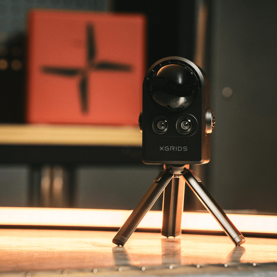
The XGRIDS PortalCam is a handheld 3DGS device with LiDAR and multi-cameras, creating photorealistic models for virtual tours, film, and more.

XGRIDS Aerial-Ground Fusion Bundle
Combine data from the XGRIDS PortalCam and DJI Matrice 4E to build comprehensive reality capture datasets.

XGRIDS Lixel K2
XGRIDS Lixel K2 is a lightweight and compact handheld scanner for true-colour point clouds and 3DGS reality capture models.

Lixel L2 Pro
XGRIDS Lixel L2 Pro is a flagship handheld SLAM-based 3D laser scanner for real-time point cloud generation and Gaussian Splatting for reality capture. Choose between a 16 and 32 channel option with different scan ranges. It can also be …

XGRIDS Lixel K1
Compact handheld scanner for professional-level 3D reality capture and modelling. Scan 200,000 points/s and generate true-colour point clouds.

XGRIDS Lixel K1 RTK Combo
XGRIDS Lixel K1 is a handheld scanner with Gaussian Splat capabilities. This combo includes the RTK module for precise RTK positioning.

XGRIDS Lixel L2 (32 Channel)
XGRIDS handheld scanner with a 300m range for rapid and accurate on-the-go mapping. Can be drone-mounted to DJI M300 Series.

XGRIDS Lixel L2 (16 Channel)
Handheld scanner with a 120m range for precision surveys. Can be drone-mouted to the DJI M300 Series.
Buying guide · Which scanner
Which XGRIDS scanner is right for you?
SLAM-based handheld scanners that take reality capture off the tripod and into walkable workflows — producing both standard point-cloud LAS / LAZ and XGRIDS’ 3D Gaussian Splatting (3DGS) photorealistic output. Choose by range, accuracy and the scale of the spaces you capture.
The accessible way into SLAM + 3DGS capture — real estate, smaller as-builts and forensic scenes.
A step up in range and accuracy for professional BIM, survey and infrastructure work.
The high-end scanner for large-scale capture, with vehicle and drone-mount options for ground + aerial fusion.
| XGRIDS PortalCam | XGRIDS Lixel K2 | XGRIDS Lixel L2 Pro | |
|---|---|---|---|
| Level | Entry | Professional | Flagship |
| Point cloud + 3DGS | Yes | Yes | Yes |
| Scale | Rooms · scenes | Buildings · sites | Large / vehicle · drone |
| From price | £3,960 | £6,499 | £20,699 |
The system around the scanner
Power, mounts and the processing software behind the point cloud.
Batteries & storage
Spare batteries, extension poles and high-capacity SSDs keep a scanning day going and hold large captures.
Accessories →Vehicle & drone mounts
Vehicle mounts and drone brackets turn the L2 Pro into a mobile and aerial-ground fusion capture system.
Mounts →Lixel CyberColor (LCC)
XGRIDS’ processing software turns raw scans into coloured point clouds and 3DGS models, on desktop or in the cloud.
Software →XGRIDS scanners — common questions
PortalCam, Lixel K2 or L2 Pro — which should I buy?
Start with the PortalCam for real estate, smaller as-builts and forensic scenes; step up to the Lixel K2 for professional BIM and survey range and accuracy; choose the L2 Pro for large-scale capture and vehicle- or drone-mounted fusion.
What is 3D Gaussian Splatting (3DGS)?
A photorealistic reconstruction technique that produces navigable, true-to-life 3D scenes alongside the measurable point cloud — increasingly used for visualisation, digital twins and stakeholder communication.
What are these scanners used for?
As-built BIM, forensic crime-scene reconstruction, real estate, museum and heritage digitisation, mining and infrastructure inspection — anywhere walkable SLAM capture beats a static tripod scanner.
Do I need extra software?
Yes — XGRIDS Lixel CyberColor (LCC) processes the raw scans into coloured point clouds and 3DGS output. We can advise on the right licence and workflow for your deliverables.
Can heliguy advise on the right kit?
Yes — as a reality-capture specialist we’ll match the scanner, mounts and software to your sector and the deliverables your clients expect.
Why buy your scanner from heliguy
Specialist consultation
Guidance on airframe, payload and workflow selection matched to your operation and sector.
Talk to a specialist →Operator training
A2 CofC, GVC and platform-specific instruction so your team flies compliant and competent.
Training courses →UK servicing
In-house DJI-authorised diagnostics, calibration and lifecycle maintenance — no shipping abroad.
Repairs & service →Hire & finance
Rental and demonstration units to trial before you commit, plus finance options for fleet purchases.
Arrange a demo →XGRIDS handhelds · BIM, forensics, real estate
High-quality point cloud + 3D Gaussian Splatting reality capture in a backpackable form.
XGRIDS handheld laser scanners take SLAM-based reality capture beyond the tripod and into walkable workflows. Used for as-built BIM, forensic crime-scene reconstruction, real estate, museum digitisation, mining and infrastructure inspection. Produces both standard point-cloud LAS / LAZ and XGRIDS' 3D Gaussian Splatting (3DGS) photorealistic outputs.
Enterprise expertise, end-to-end support, trusted UK delivery
Buying the Handheld Laser Scanners from heliguy means full lifecycle support, not just the aircraft.
Product consultation
Guidance on variant selection, payload pairing and sector use cases.
Training & onboarding
Industry-specific instruction on workflows, mission execution and CAA compliance.
Survey & integration
Expert support turning drone data into accurate digital models and decisions.
DJI-authorised repairs
UK-based diagnostics, servicing and lifecycle maintenance — keeping your fleet in the air.
Adding handheld reality capture?
Talk to a heliguy specialist about XGRIDS hardware vs cloud-processing pipelines and integration with aerial LiDAR.